Chamues-ch-Fuorcla Chaschauna-Prasüras
24,62 km
8:07 hrs.
1.110 m
1.125 m
100
TOP Difficult
Best season
JanFebMarAprMayJunJulAugSepOctNovDec
Download
Starting point of the tour
village square of Chamues-ch
Destination of the tour
S-chanf Prasüras parking area
Lowest point
1.692 m
Highest point
2.817 m

Properties
- Scenic
- Faunistic highlights
- Refreshment stops available
- Cultural/historical value
- Botanical highlights


Fuorcla Chaschauna

Blick zurück ins Val Chamuera
Alp Serlas

Aufstieg zur Fuorcla Chaschauna mit grandioser Aussicht auf Piz Palü und Piz Bernina
This long tour leads you through pristine alpine scenery which is rather far away from civilisation.
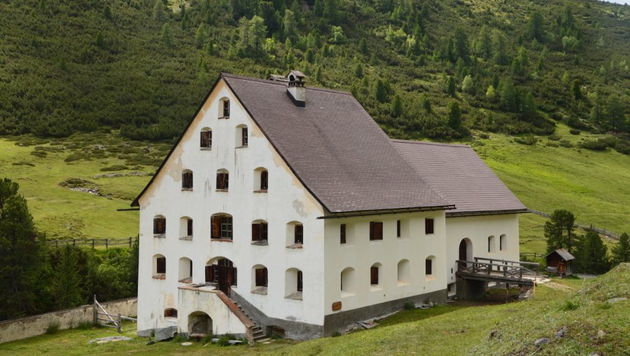
You start at the village square of Chamues-ch, the trail leads you on the gravel road into the Val Chamuera. In the center of the valley at 2'16 m above sea level, you find an astonishing building. This was the most important alpine farm hut of the Canton of Grisons built in the 19th century. Originally a dairy, it was inhabited in winter, too, until 1836. Here you make a sharp left turn. After the Alp Timun you take the steep ascent to the Fuorcla Chaschauna up at 2'802 m. On the other side of the pass, the occasionally very steep descent into the Val Chaschauna begins. Past the Alp Chaschauna, you follow the gravel road that leads to S-chanf. Just befor the bridge Punt da Scrin you take the narrow hiking path that leads above the river to the Prasüras parking area.
More information
Engadin Tourismus AG
Via Maistra 1
CH-7500 St. Moritz
Phone: +41 81 830 00 01
E-mail: allegra@engadin.ch
Internet: www.engadin.ch
Properties
village square Chamues-ch - Alp Serlas - Alp Timun - Fuorcla Chaschauna - Alp Chaschauna - Prasüras
Tip of the author
The rocks around the Fuorcla Chaschauna provide a habitat for ibex and chamois. Golden eagles and bearded vultures also like to circle in the sky.
Safety information
Until well into June, you should expect snow fields around the Fuorcla Chaschauna.
Map and arrival