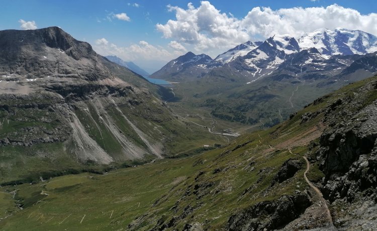
Checked shirts, red socks and hiking pole. The cliché image of hiking is long gone: today, it is en vogue to switch off smartphone and laptop every once in a while and go for a hike in the beauty of nature. And Pontresina is the perfect venue for it: with its 580 km network of hiking trails, it is one of the most popular hiking destinations in Switzerland. Among the highlights are hikes through the ruggedly romantic Rosegtal or on Muottas Muragl – postcard views of the Upper Engadine lakes and the Piz Bernina guranteed. Or the high mountain hike from Muottas Muragl to Alp Languard. The trail leads through the territory of the largest ibex colony in Switzerland. And for those wanting even more, a hike through the only Swiss National Park – just a stone's throw from Pontresina – is a must. Remember to discover Pontresina's Ibex Paradise.
Hiking in Pontresina, the Engadine
Search results: 44 Tours found
 Diavolezza valley station-Fuorcla Pischa-Fuorcla Prünella-Chamues-ch Long hike on little-used hiking trails in the Engadin. 22,48 km 7:30 hrs. 897 m 1.271 m 95 TOP Difficult
 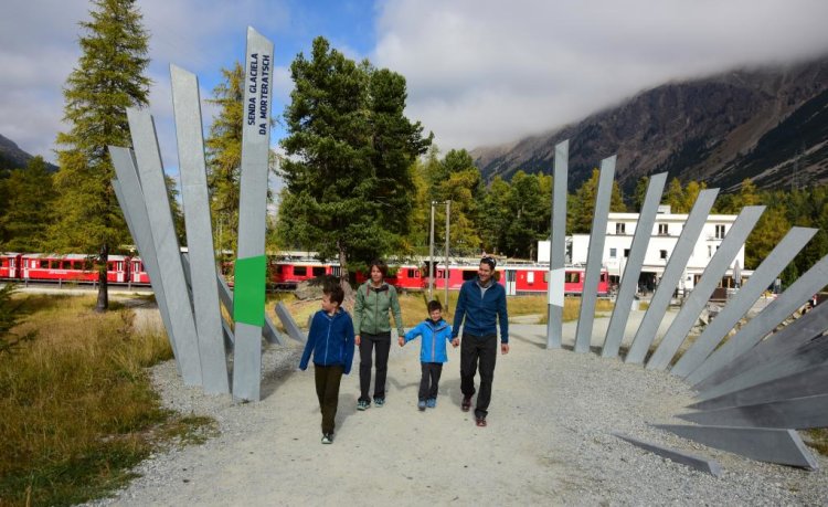 Morteratsch Glacier Trail Step by step along the track of the third longest glacier of the Eastern Alps. 2,88 km 0:50 hr 130 m 0 m 95 TOP Easy
  Corvatsch Murtèl - Fuorcla Surlej - Val Roseg Diversion in Val Roseg!Getting up close and personal with glaciers - once upon a time, today, and in the future. One of the most impressive hiking tours takes you from the Corvatsch Murtèl middle station across the Fourcla Surlej back down into the Val Roseg and on to Pontresina. 13,64 km 3:45 hrs. 100 m 1.027 m 94 Stage Tour TOP Moderate
 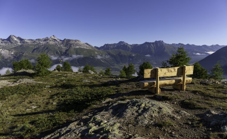 Muottas de Schlarigna - Lake Staz Through the forest up to the lookout point Muottas da Schlarigna and to the oldest Swiss stone pines in the Upper Engadin. 14,18 km 4:35 hrs. 568 m 557 m 94 TOP Moderate
 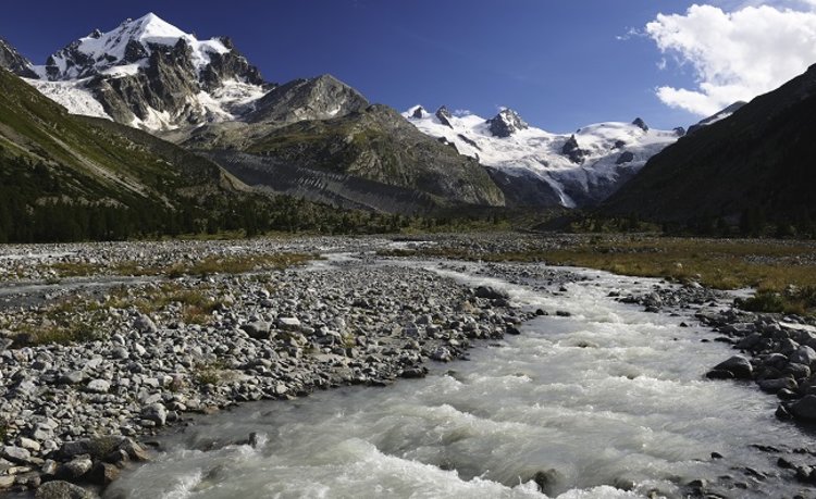 Pontresina - Val Roseg - Pontresina Diversion in Val Roseg!This tour of the charming Val Roseg, an official Alpine quiet zone, starts at Pontresina railway station. 13,80 km 3:30 hrs. 227 m 227 m 93 TOP Easy
 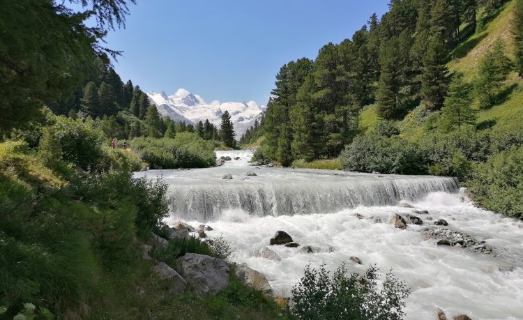 53 Bernina-Tour: Stage 4 Pontresina-Surlej Diversion in Val Roseg!Through the lovely Val Roseg to the Fuorcla Surlej with magnificent views on the famous Biancograt. 13,14 km 5:00 hrs. 1.021 m 101 m 93 Stage Tour TOP Moderate
  53 Bernina-Tour: Stage 2 Bernina Pass-Diavolezza From the Bernina Pass up to the Diavolezza with spectacular views of Piz Palü and Piz Bernina with the legendary Biancograt 8,76 km 4:00 hrs. 805 m 74 m 93 Stage Tour TOP Difficult
  53 Bernina-Tour: Stage 3 Diavolezza-Fuorcla Pischa-Pontresina From the glacier world of Diavolezza over the stone desert of Fuorcla Pischa down to the mountaineering village Pontresina. 10,86 km 4:30 hrs. 804 m 566 m 93 Stage Tour TOP Difficult
 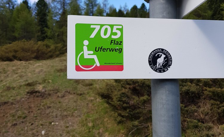 Meadobs from Pontresina to Bever Hike along the new Flaz from Pontresina to Bever. 9,73 km 2:26 hrs. 16 m 80 m 92 Stage Tour TOP Moderate
 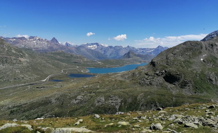 Diavolezza valley station - Lej Pers - Val d'Arlas - Diavolezza valley station This hike leads through barren mountain landscapes and past beautiful mountain lakes. 11,95 km 4:25 hrs. 725 m 725 m 91 Stage Tour TOP Difficult
 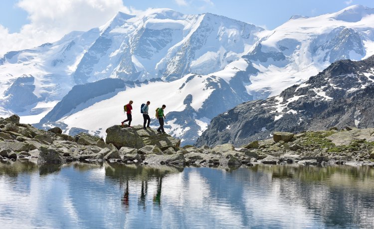 Morteratsch railway station - Boval Hut A magnificent path through the Morteratsch valley, which impressively illustrates thousands of years of earth history 10,61 km 3:38 hrs. 597 m 595 m 91 Stage Tour TOP Moderate
  53 Bernina-Tour: Stage 3 Diavolezza-Fuorcla Pischa-Pontresina From the glacier world of Diavolezza over the stone desert of Fuorcla Pischa down to the mountaineering village Pontresina. 10,87 km 4:30 hrs. 806 m 568 m 91 Stage Tour TOP Difficult
 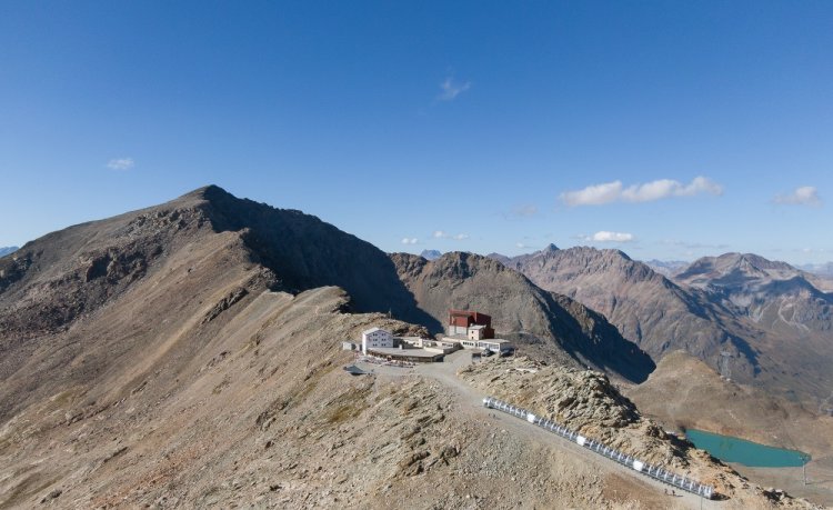 Diavolezza - Munt Pers A well laid-out, but narrow mountain path takes you from Diavolezza mountain station up to Munt Pers. 3,88 km 1:35 hrs. 240 m 240 m 90 Stage Tour TOP Easy Corvatsch Murtèl - Chamanna Coaz - Val Roseg Diversion in Val Roseg!A close-up view of the glaciers - in the past, today and in the future. This impressive hiking tour goes from the Corvatsch Murtèl middle station across the Fourcla Surlej to the Chamanna Coaz high above the Val Roseg valley and down to the Restaurant Roseg Gletscher to Pontresina. 24,42 km 6:40 hrs. 317 m 1.237 m 90 TOP Moderate
  804 Muottas da Schlarigna Diese Tour bietet faszinierende Einblicke in einen alten Arvenwald sowie Ausblick auf die einmalige Seenlandschaft des Oberengadins. 8,92 km 3:42 hrs. 554 m 549 m 90 Stage Tour TOP Moderate
  Diavolezza - Lej da las Collinas - Lej Pers - Diavolezza valley station From the Diavolezza mountain station, a hiking trail leads past small lakes and a moorland area down to the Diavolezza valley station. 9,63 km 3:25 hrs. 218 m 1.123 m 88 Stage Tour TOP Moderate
 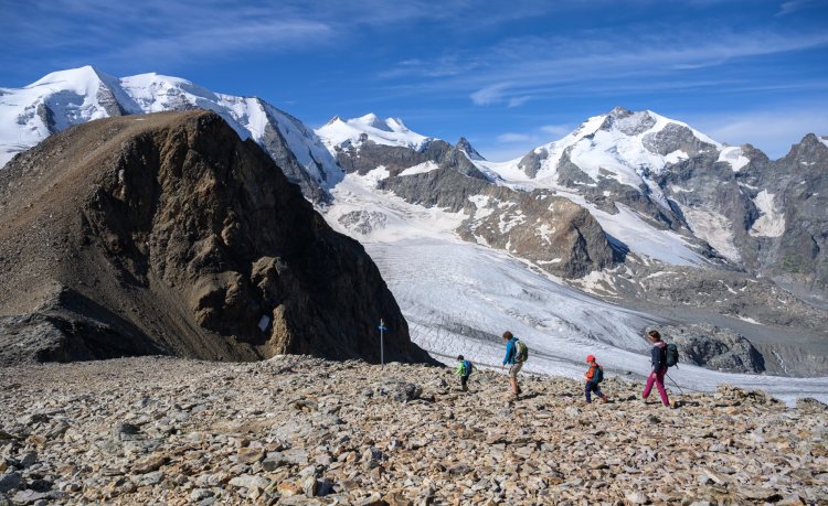 Diavolezza - Lej da Diavolezza From the Diavolezza mountain station, past the Lej da Diavolezza, down to the Diavolezza valley station. 6,19 km 2:05 hrs. 32 m 932 m 87 Stage Tour TOP Moderate
  Val d'Arlas On the descent from Diavolezza you have a beautiful view of the deep blue lakes Lej da Diavolezza and Lago Bianco. 7,45 km 2:25 hrs. 38 m 931 m 87 Stage Tour TOP Moderate
 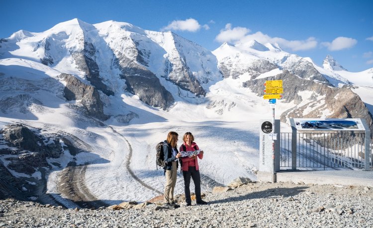 Glacier Experience Trail Experience the glacier up close in this 1.5–2-hour trail. The nature trail takes you past five stations that explore the changes undergone by the glacier 1,79 km 1:45 hrs. 215 m 215 m 86 Stage Tour TOP Moderate
 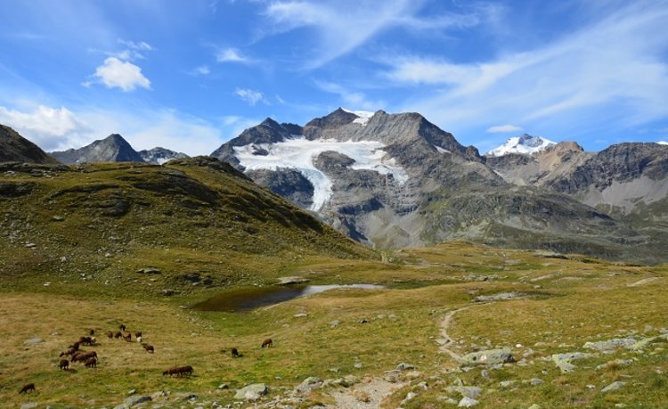 Lagalb - Val Minor - Motta Bianca - Lagalb The hike starts at the valley station of the Lagalb cable car and leads around Piz Lagalb. 9,89 km 3:08 hrs. 380 m 378 m 85 Stage Tour TOP Moderate
  806 Aussichtsweg Morteratschgletscher This tour offers a unique view of the ice giants around the Morteratsch Glacier and the Bernina massif. The Morteratsch Glacier near Pontresina (Rhaeto-Romanic Vadret da Morteratsch or Glatscher dal Morteratsch) is one of the largest glaciers in the Eastern Alps.It is one of the glaciers in the Bernina Group in the canton of Graubünden in Switzerland. Like all Alpine glaciers, the Morteratsch glacier is also affected by extensive shrinkage as part of global warming; it shortened by around 2,500 meters between 1900 and 2017. 5,80 km 2:10 hrs. 253 m 253 m 85 TOP Moderate
 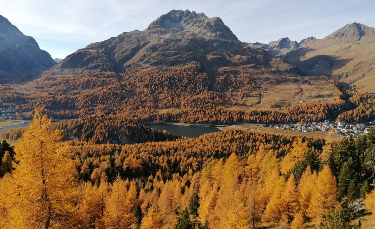 Surlej-Hahnensee-Muottas da Schlarigna-Pontresina The hike offers fantastic views and leads past the Hahnensee, one of the most idyllic places in the Engadin. 12,95 km 4:30 hrs. 707 m 742 m 85 Stage Tour TOP Moderate
 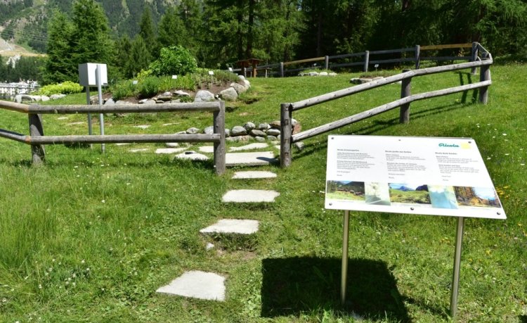 Ricola Herb Garden and Tais forest Take things easy, relax and inhale the fresh mountain air. This family-friendly, easy-going tour first takes you to the Ricola Herb Garden, at the entrance to the Roseg valley, and then into the Tais Forest. 3,02 km 0:50 hr 44 m 43 m 85 TOP Easy
  33.07 St. Moritz - Ospizio Bernina Unsere Tipps für folgende Etappe der Via Albula / Bernina:Gletscherwelt des MorteratschDie Wasserscheide Lago Bianco-Lej Nair auf dem BerninapassDie höchsten Berge Graubündens - die Berninagruppe 29,59 km 8:15 hrs. 598 m 287 m 84 Stage Tour TOP Moderate
 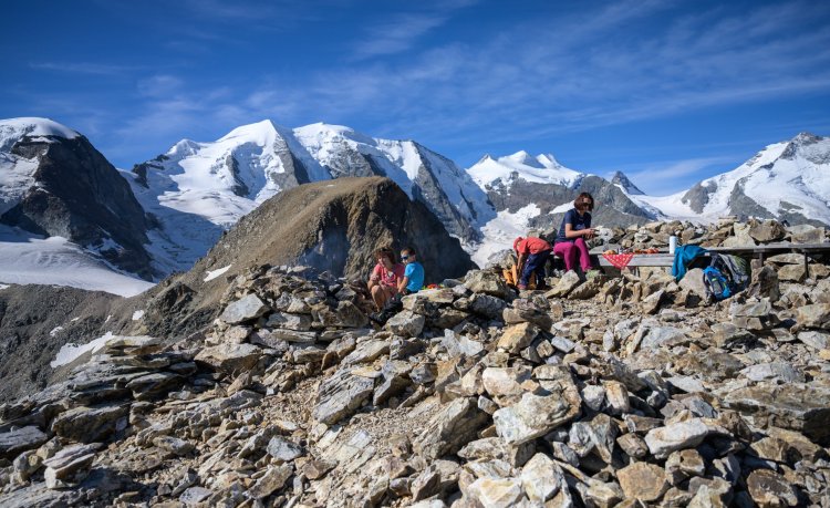 Diavolezza - Sass Queder Hike to the highest barbecue site in Europe 1,55 km 0:35 hr 123 m 123 m 82 Stage Tour TOP Easy
 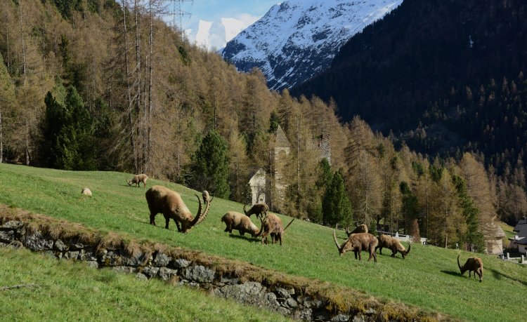 Ibex Promenade The Ibex Promenade is a one-kilometre hiking trail suitable for prams and featuring seven stops with entertaining information for children and grown-ups on the nature of ibices, their habitat and geographical presence. 1,25 km 0:20 hr 28 m 26 m 82 TOP Easy
 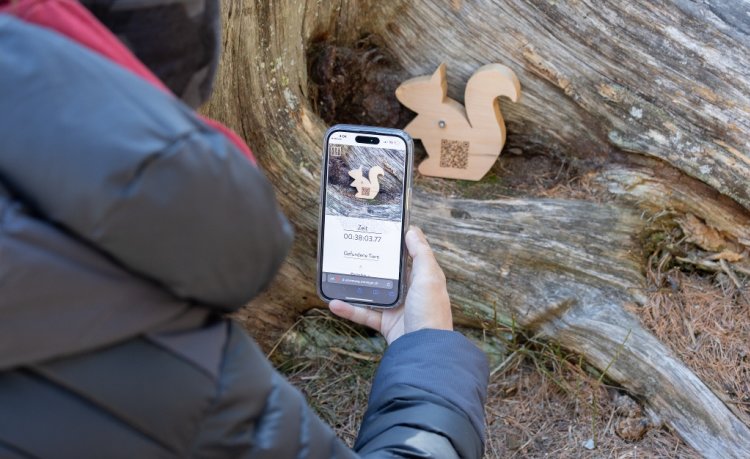 Rominger pine path In Pontresina, at the entrance to the Val Roseg, stretches the Taiswald. In addition to a diverse population of stone pines and larches, many local animal species also feel at home here. The Rominger Arvenweg (Swiss stone pine trail) leads right through the Tais forest, where there is much worth knowing about the stone pine and the forest. 760 m 0:30 hr 4 m 38 m 74 Stage Tour TOP Easy
  30.04 S-chanf - Pontresina, ViaValtellina Through the wide, open mountain landscape of the Upper Engadine from S-chanf via Zuoz and Samedan to Pontresina. Picturesque villages with old manor houses and hotel buildings from the era of belle époque, alternating with a unique natural landscape. 20,69 km 5:30 hrs. 250 m 104 m 72 Stage Tour TOP Moderate
  30.05 Pontresina - Alp Grüm, ViaValtellina Surrounded by an impressive mountain landscape from Pontresina through the Val Bernina and over the Bernina Pass to Alp Grüm. Insight into the effects of climate change in Pontresina and Morteratsch and views from Alp Grüm into Val Poschiavo. 21,33 km 6:29 hrs. 549 m 233 m 72 Stage Tour TOP Moderate
 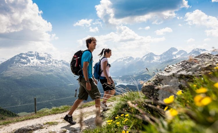 25.04 St. Moritz - Muottas Muragl, Senda Segantini Our tips for the following stage of the Senda Segantini:Segantini hut: This is where the artist died unexpectedly on September 28, 1899. Today, the Segantini Hut with its fabulous view is a popular excursion destination.Muottas Muragl: The Engadin lies at your feet here. One of the most beautiful vantage points in the Engadin. 14,78 km 5:25 hrs. 1.140 m 456 m 71 Stage Tour TOP Moderate
  Ascent Morteratsch glacier The ascent to the Morteratsch glacier starts at the wooden bridge at the end of the Morteratsch glacier trail. The short mountain hike (approx. 30 min.) leads over scree and a rock step up to the glacier tongue. The path is not clearly visible everywhere. It is therefore important to keep the white-red-white markings in sight at all times.ATTENTION: The glacier has crevasses and invisible cavities and is in constant motion. This leads to sudden ice break-offs. The marked trail ends before the glacier tongue, to go on the glacier is only recommended with a mountain guide and appropriate equipment. 810 m 0:35 hr 161 m 0 m 70 Stage Tour TOP Moderate 53 Bernina-Tour: Stage 4 Pontresina-Surlej Diversion in Val Roseg!Through the lovely Val Roseg to the Fuorcla Surlej with magnificent views on the famous Biancograt. 13,65 km 5:00 hrs. 1.018 m 122 m 100 Stage Tour TOP Moderate
  Alp Languard - Las Sours - Senda dal Stambuoch - Alp Languard Las Sours is a prominent mountain peak in the Languard area. You can't get to the main summit, but thelower summit is already an experience. 13,25 km 5:35 hrs. 1.218 m 1.218 m 100 Stage Tour TOP Difficult 53 Bernina-Tour: Stage 2 Bernina Pass-Diavolezza From the Bernina Pass up to the Diavolezza with spectacular views of Piz Palü and Piz Bernina with the legendary Biancograt 8,76 km 4:00 hrs. 805 m 74 m 100 Stage Tour TOP Difficult
  Muottas Muragl Panorama Trail Panoramic trail with great views on the Engadin lake-strewn plateau and the Bernina Massif. 6,80 km 2:00 hrs. 104 m 230 m 100 TOP Easy
  Val da Fain - Fuorcla Pischa - Paradis Hut The hike starts easily, by taking the bus or train to Bernina Diavolezza. 13,45 km 5:05 hrs. 864 m 1.119 m 100 Stage Tour TOP Difficult
 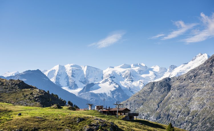 Alp Languard - Paradis hut - Pontresina This easy tour starts by taking the chairlift up to Alp Languard (2,326m/7,631ft). 7,10 km 2:23 hrs. 212 m 711 m 100 TOP Easy
  Muottas Muragl - Segantini hut - Pontresina Follow in the footsteps of the famous artist, Giovanni Segantini, to one of the most beautiful vantage points in the Upper Engadin 6,49 km 2:29 hrs. 389 m 516 m 100 Stage Tour TOP Moderate
  Bernina Trek classic: stage 5 Chamanna da Tschierva-Chamanna da Boval Diversion in Val Roseg!From the Val Roseg via Pontresina into the Val Morteratsch 22,03 km 6:40 hrs. 705 m 800 m 100 Stage Tour TOP Moderate
  Bernina Trek classic: stage 6 Chamanna da Boval-Rifugio Saoseo From the glacier mountains of the Bernina range to the plant kingdom of the Val da Camp. 28,37 km 9:01 hrs. 772 m 1.267 m 100 Stage Tour TOP Difficult
 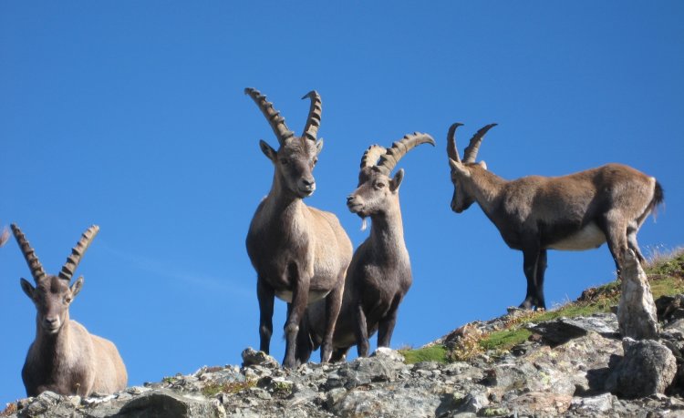 Paradis tour This tour is an entertaining hike affording marvellous views of the Bernina mountain range and, if you are lucky enough, a glimpse of one or the other ibex 4,85 km 1:37 hrs. 248 m 248 m 100 TOP Easy
  Adventure trail "Fix shows you his world" Along a beautiful hiking trail with interactive information points, visitors discover the world of the fox.Currently closed due to danger of falling rocks! 6,42 km 1:50 hrs. 213 m 4 m 100 Stage Tour TOP Moderate
  Audiotour glacier trail Morteratsch Allow yourself the time and listen to literary tidbits, anecdotes, poems and tour reports that will take you back to the most diverse eras. 2,91 km 0:49 hr 130 m 0 m 100 Stage Tour TOP Easy
  Cascada da Bernina The waterfall path "Cascada da Bernina". Translated from the Rhaeto-Romanish, "Cascada" means waterfall. The mountain stream "Ova da Bernina" plunges over two hundred metres in altitude down to the valley. In addition to the rushing spectacle, visitors can also expect pioneering technical achievements. 584 m 0:16 hr 85 m 0 m 100 TOP Moderate